


 Fairfield County Genealogy Society
Members Only
Maps
United States Websites
USGS Historical Topographic Map ExplorerNational (USGS) map with LiDAR
Each State and its Counties (Inter-Active PDF) by U.S. Census Bureau
Map Collection hosted by Library of Congress
David Rumsey Historical Map Collection hosted by Cartography Associates
South Carolina Websites
South Carolina (Maps) by University of South Carolina Digital LibrarySC Historical Maps By Location by SCIWAY Project
Carolina Places hosted by Rootsweb an Ancestry.com community
South Carolina Maps
(Intended For Research Purposes Only!)
Hold down CTRL key and press - (minus) key to reduce map
Hold down CTRL key and press 0 (zero) key to reset size back to normal
Also maps may load very slow depending on your service providers)
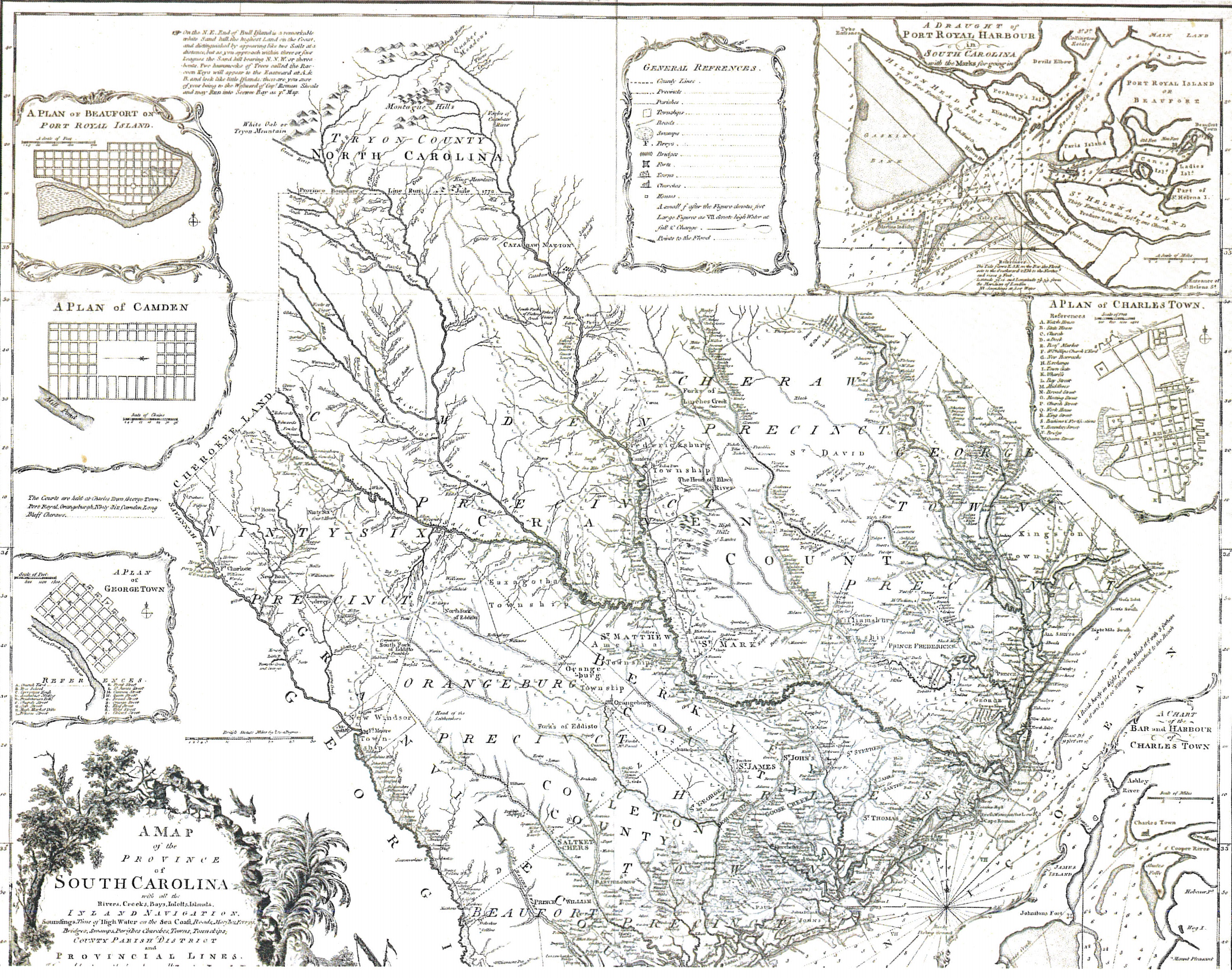 Early Colonial By Mouzon or Cook |
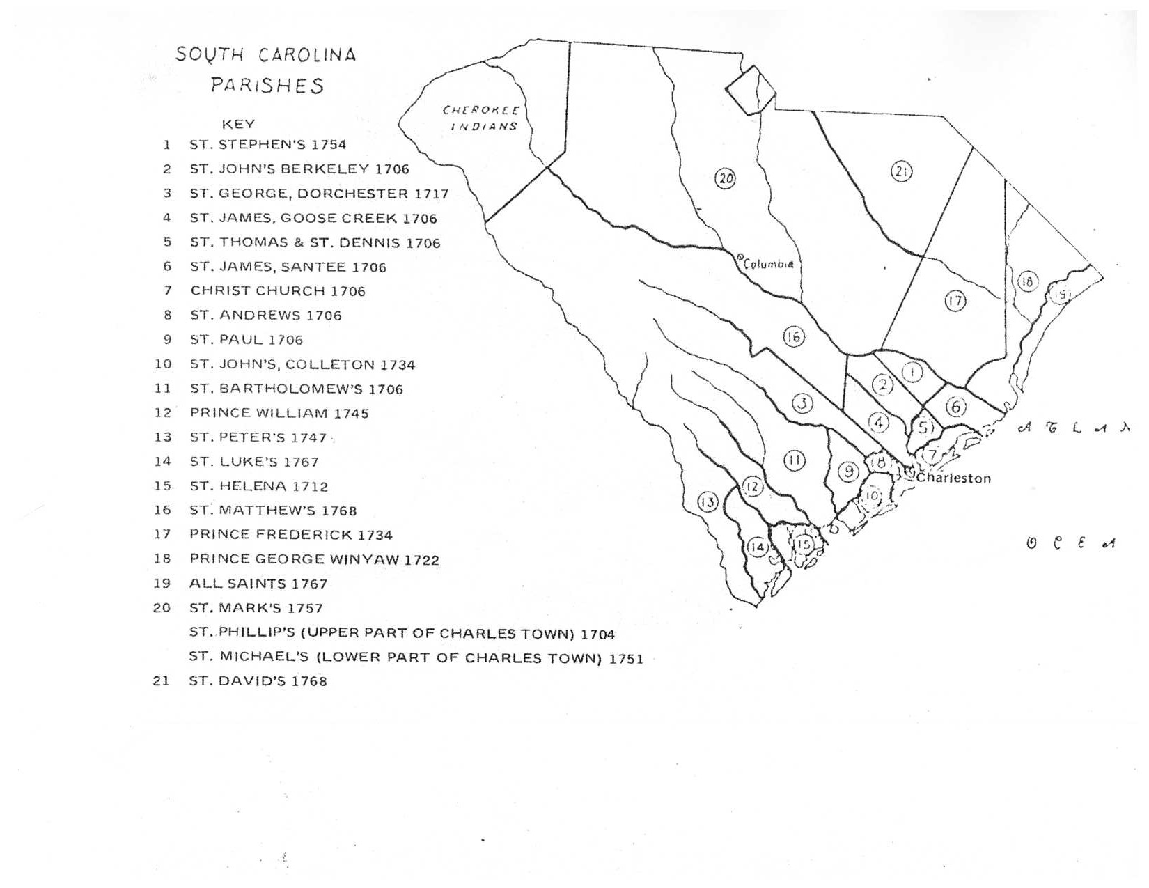 Early Parishes By Brent H. Holcomb SC MAR |
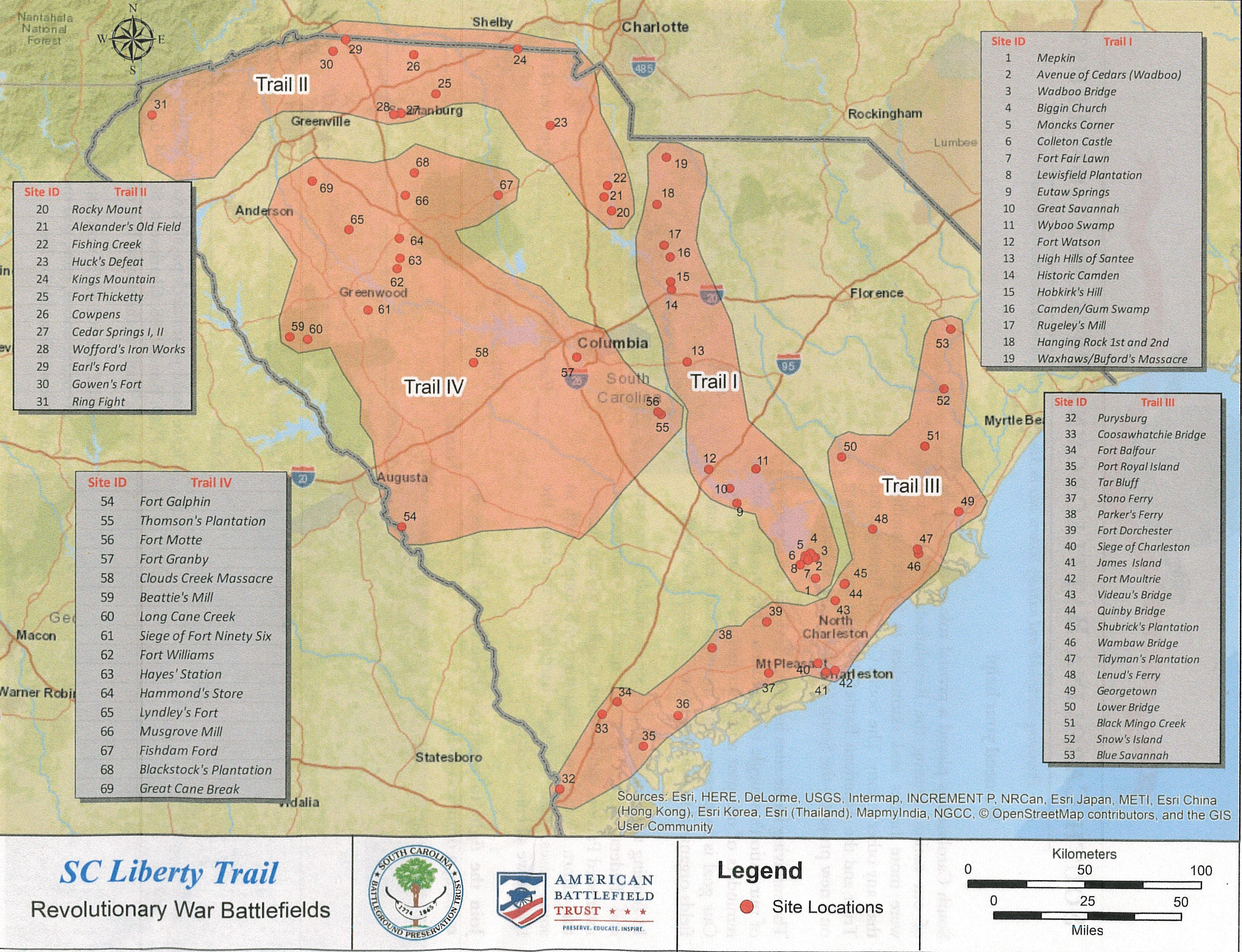 1780-1781 SC Liberty Trail American Revolutionary War Sites By SC Battleground Preservation Trust |
 1785 Counties & Circuit Court Districts By Brent H. Holcomb SC MAR |
 1791-1799 Equity Court Districts By Brent H. Holcomb SC MAR |
 1800 Circuit Court Districts By Brent H. Holcomb SC MAR |
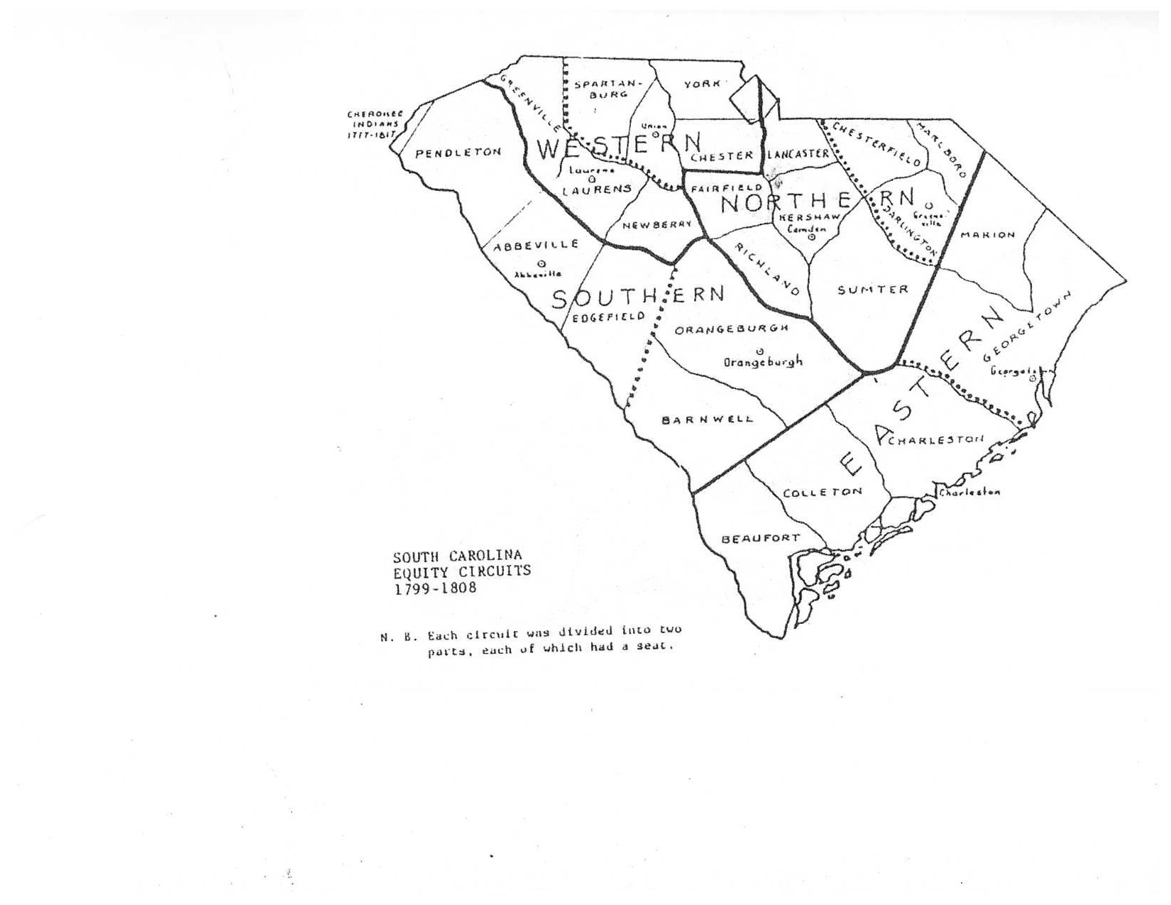 1799-1808 Equity Court Districts By Brent H. Holcomb SC MAR |
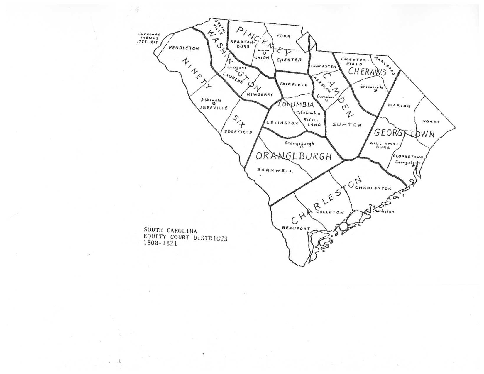 1808-1821 Equity Court Districts By Brent H. Holcomb SC MAR |
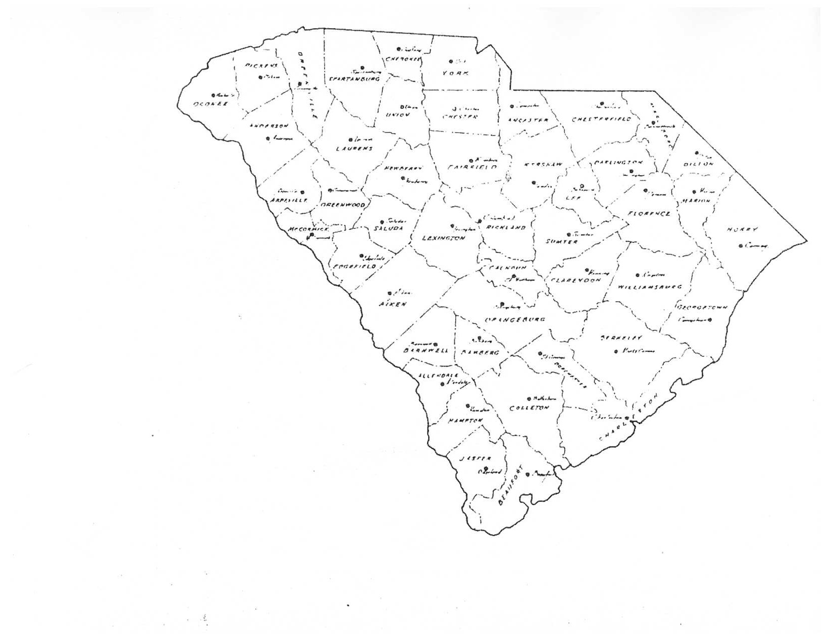 Present Day Counties By Brent H. Holcomb SC MAR |
|
South Carolina Early Maps
(Intended For Research Purposes Only!)
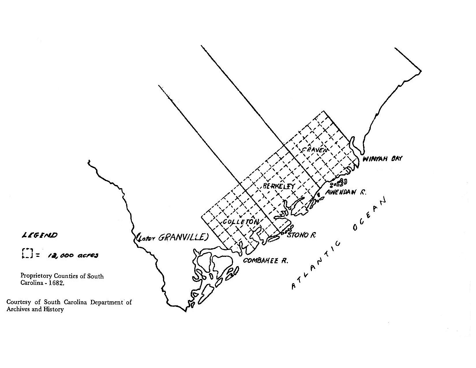 1682 By SC Dept. of Archives & History |
 1710 |
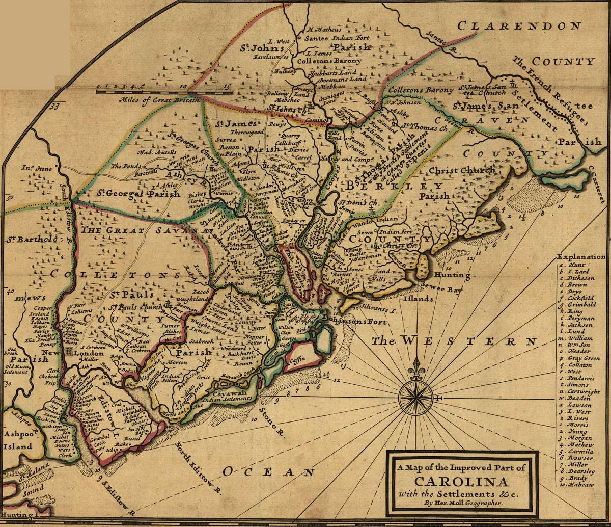 1731 By Herman Moll |
 1769 By SC Dept. of Archives & History |
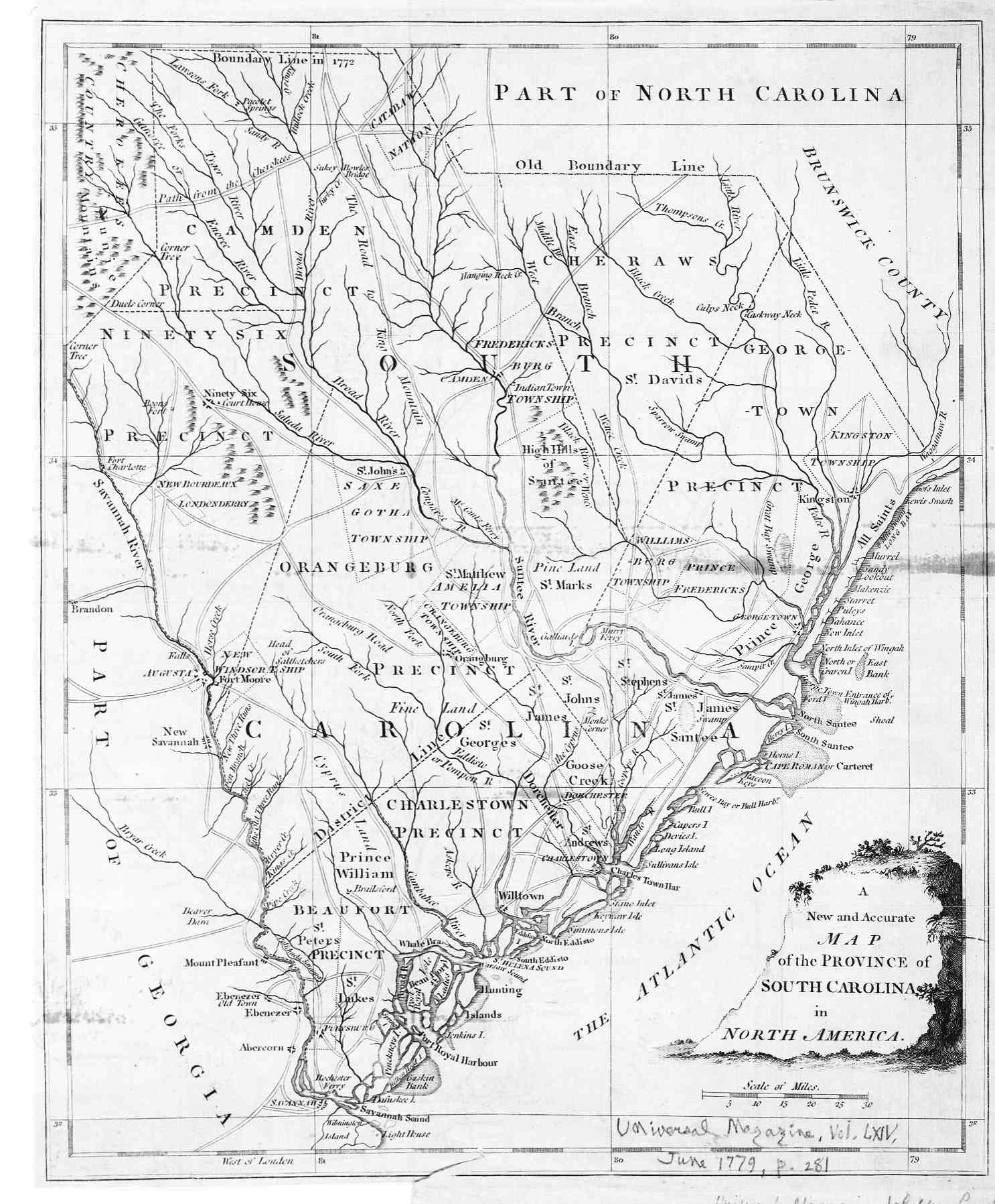 1779 By Universal Magazine June 1779 |
 1682-1785 By Brent H. Holcomb SC MAR |
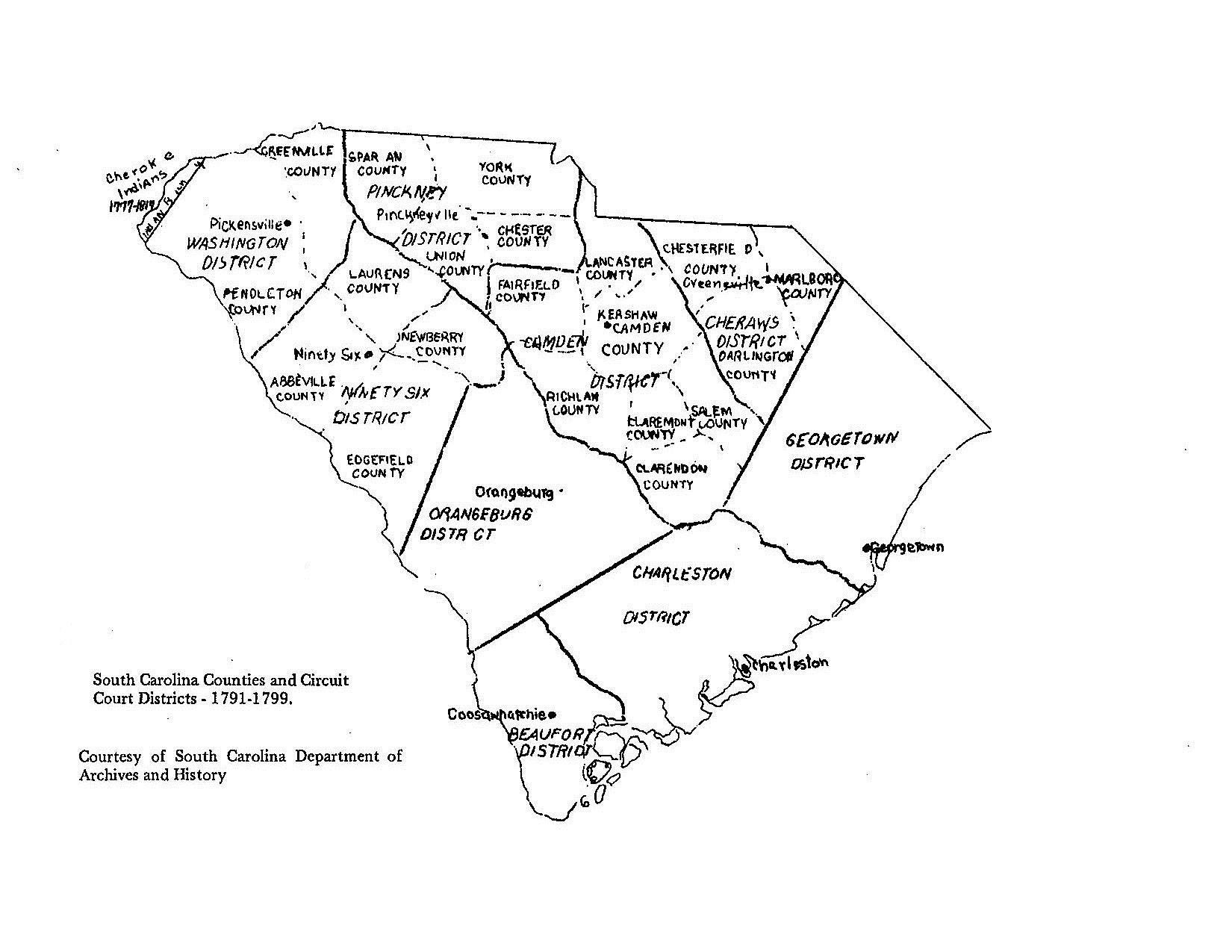 1791-1799 By SC Dept. of Archives & History |
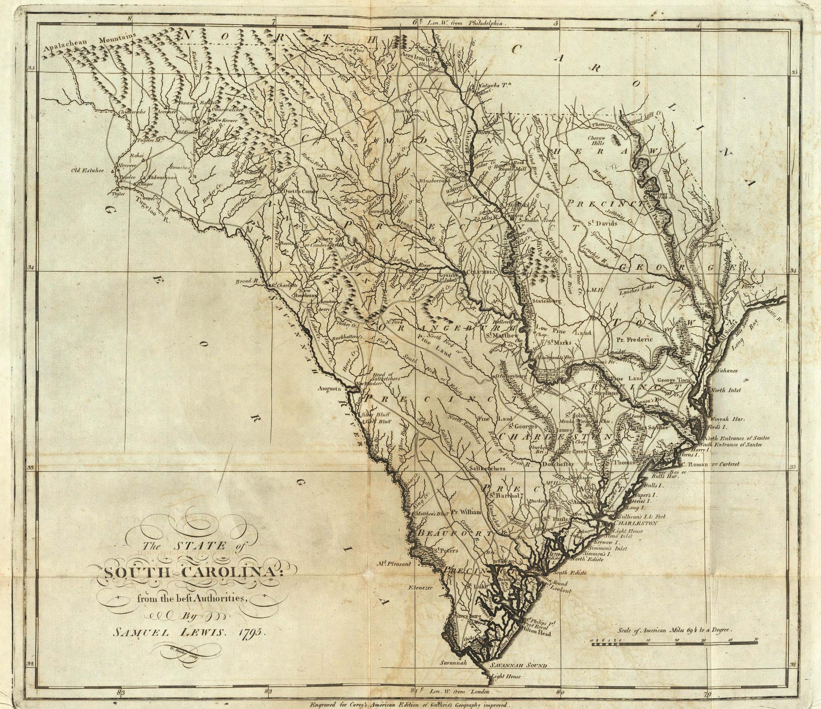 1795 By Samuel Lewis |
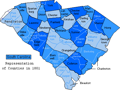 1801 By Dowdy |
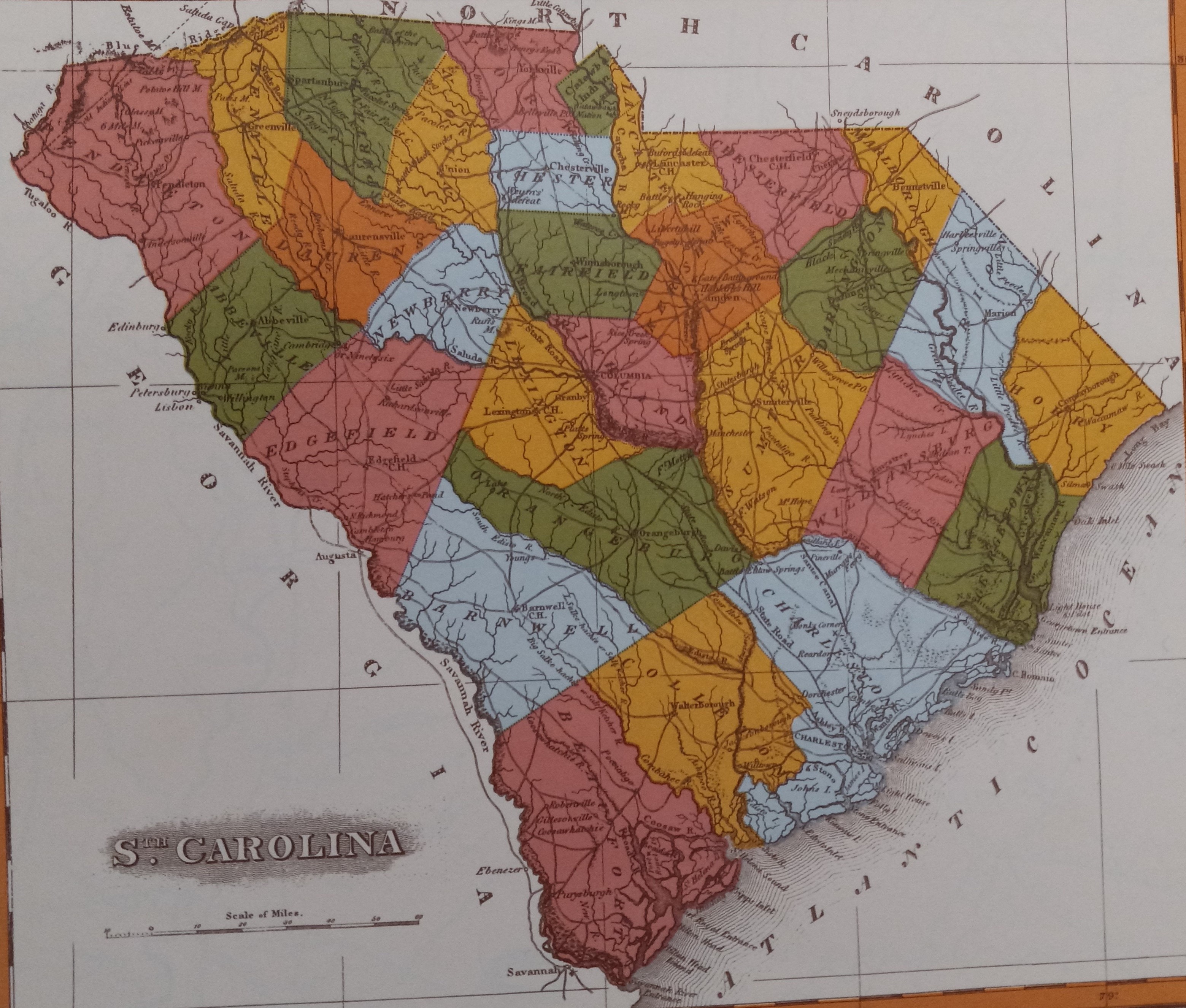 1820 By Robert Mills |
South Carolina - North Carolina
(Intended For Research Purposes Only!)
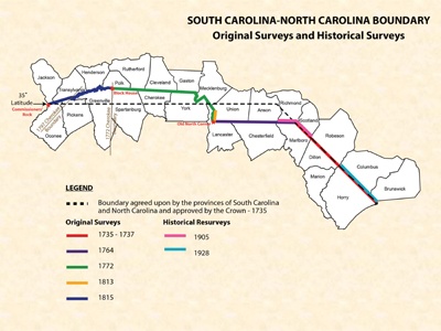 SC-NC Boundary Original & Historical Surveys |
 SC-NC Boundary Original & Historical Surveys |
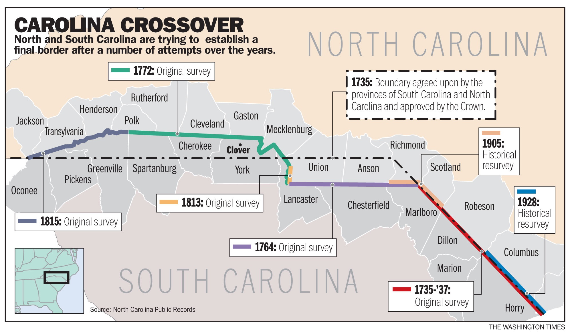 SC-NC Boundary Carolina Crossovers NC Public Records |
||
Fairfield County
(Intended For Research Purposes Only!)
 1820 By Robert Mills |
 1820 & Surrounding Counties By Suzanne Johnson Using Robert Mills |
 1838 By George W. Boynton |
 1852 |
 1854 By Cook |
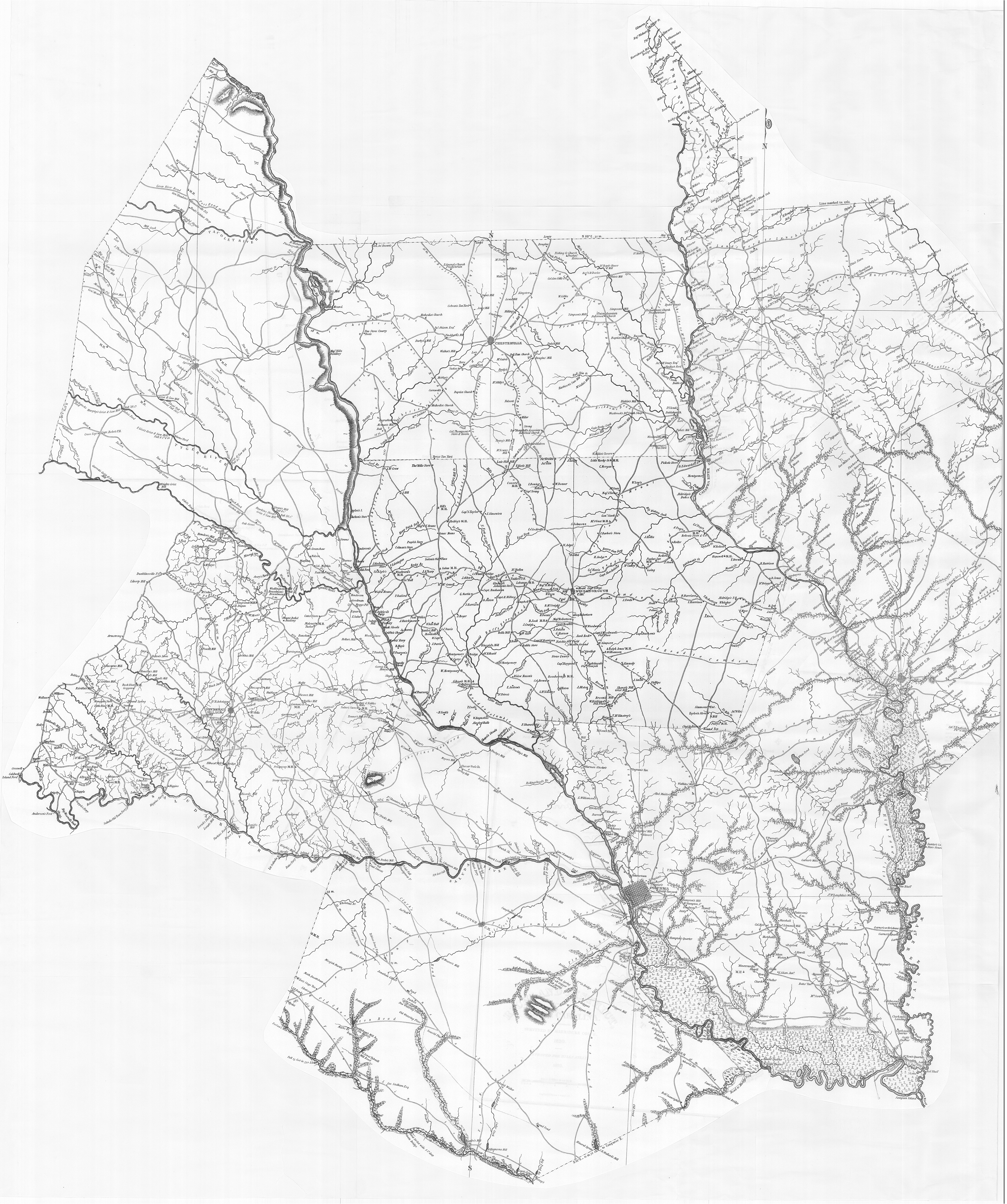
 1864 By Robert Mills |
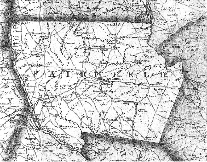
 1873 Geo. & Ag. By E. M. Stoeber |
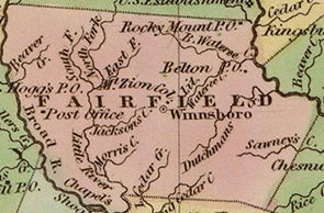
 1876 (Color) By B.E. & W.B. |
 1876 By B.E. & W.B. |
 1888 New & Herald 25 April 1888 |
 1896 Post Offices |
 1908 By Jones, Requarth & Kelsey |
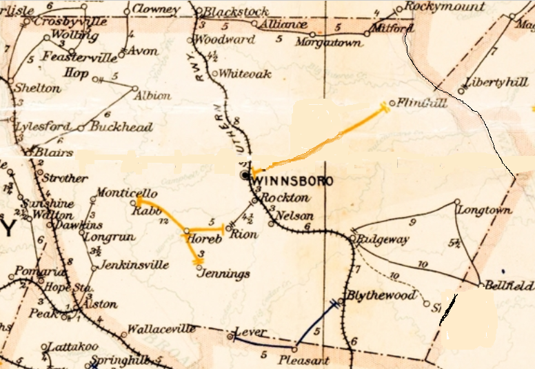
 1939 By SC State Highway Dept. |
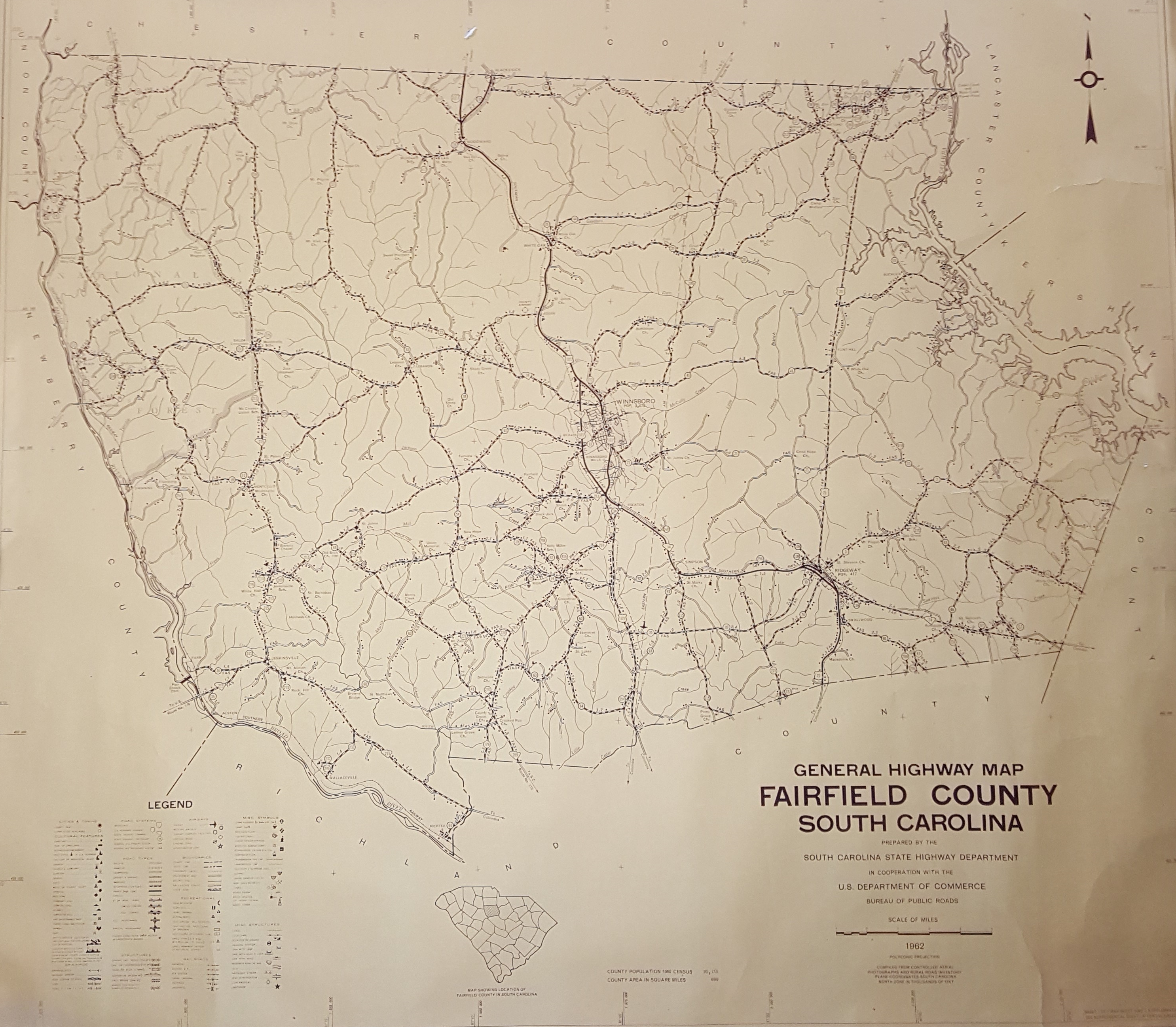 1962 By SC State Highway Dept. |
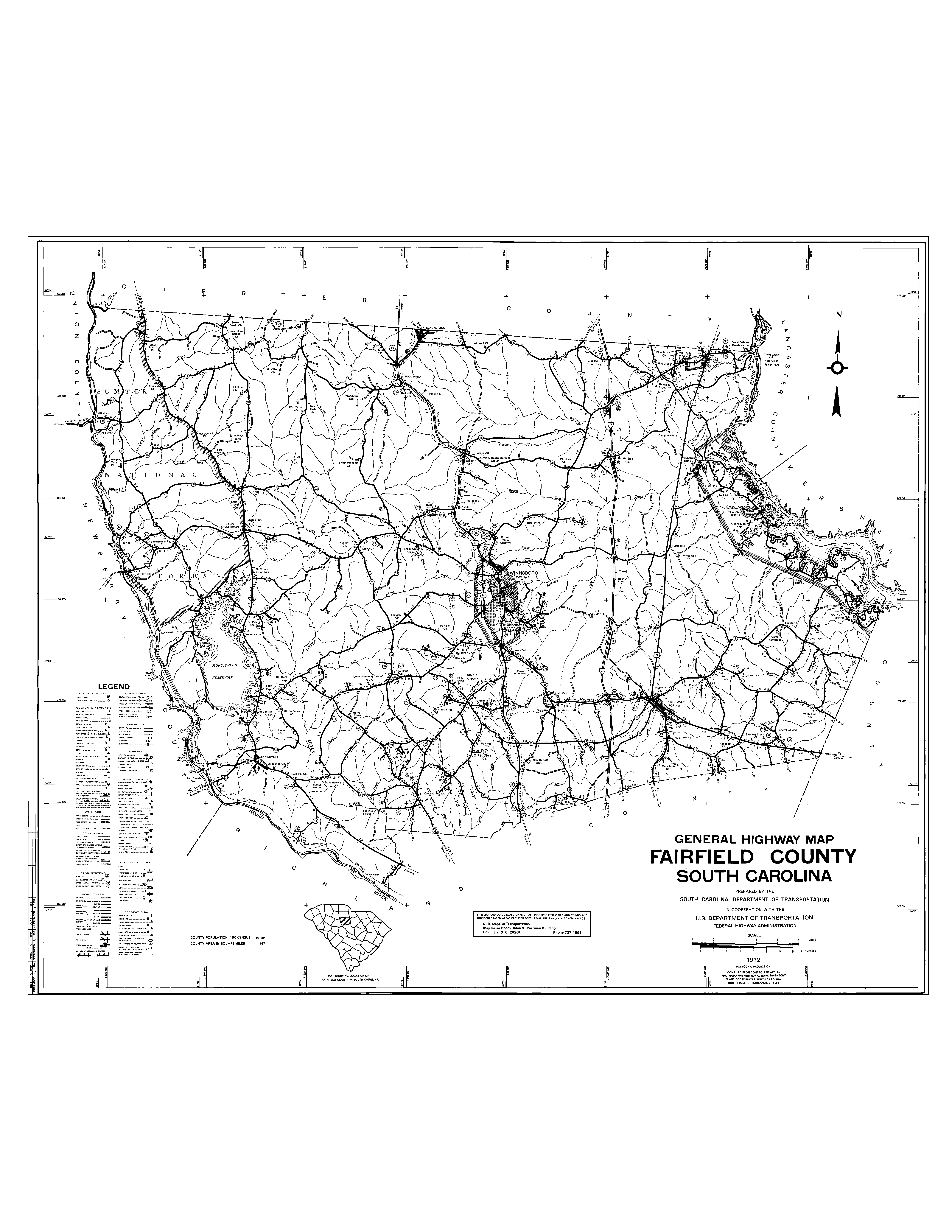 1970 By SC State Highway Dept. |
 2008 By SC State Highway Department |
 Family Graveyards Labeled by J. Davis Using 2014-2015 SC DNR Map |
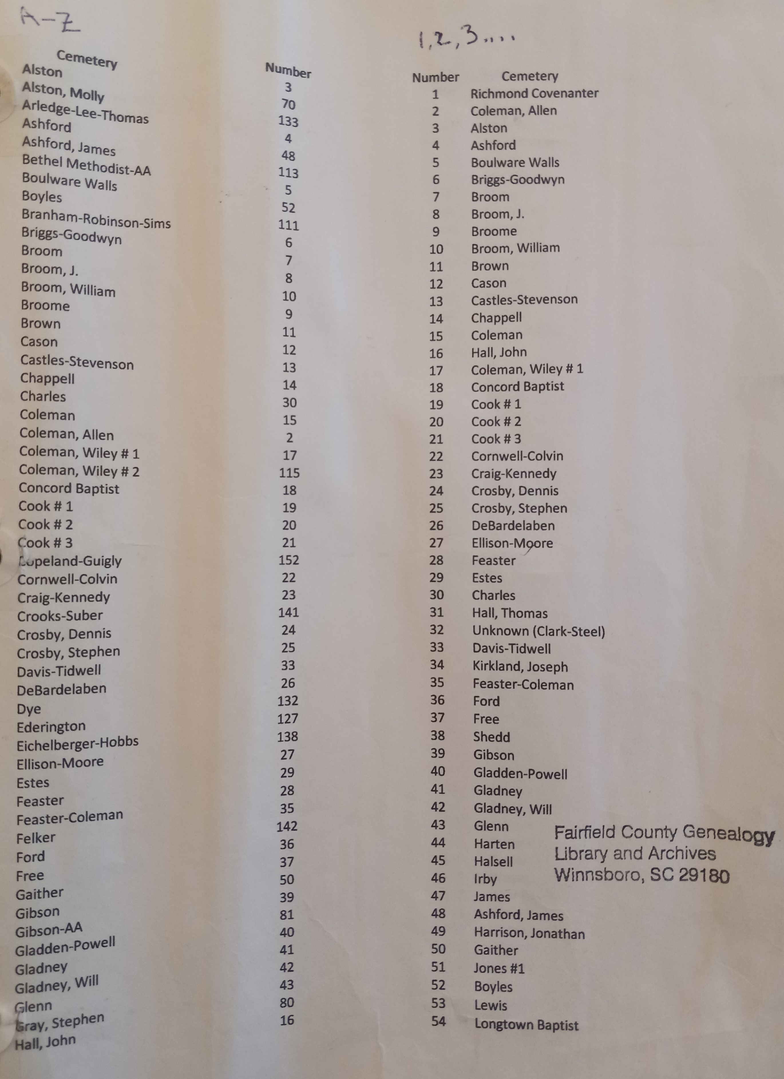 Family Graveyards Map Index Alston Thru Hall |
 Family Graveyards Map Index Hall Thru Poplar Springs |
 Family Graveyards Map Index Rabb Thru Yongue |
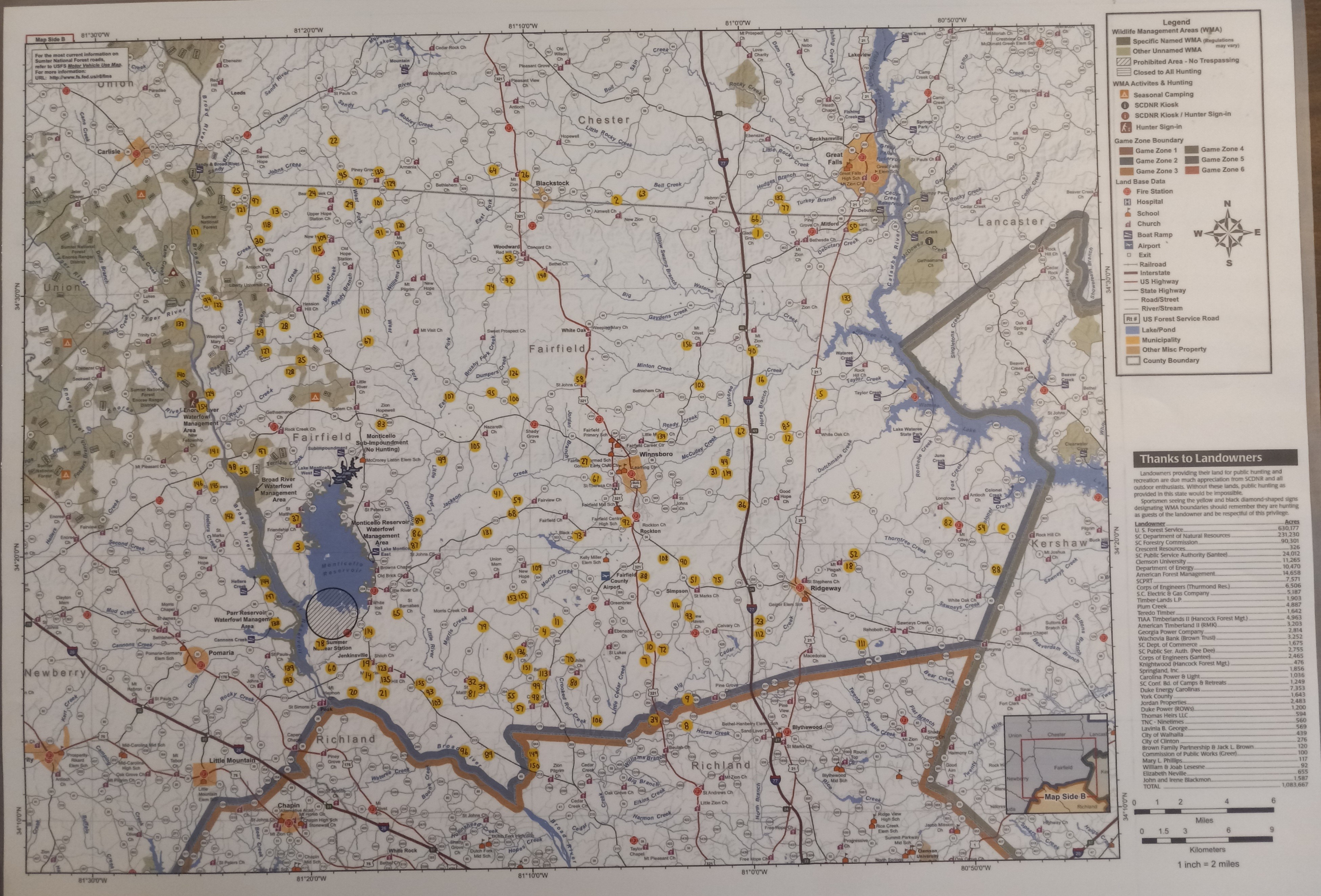
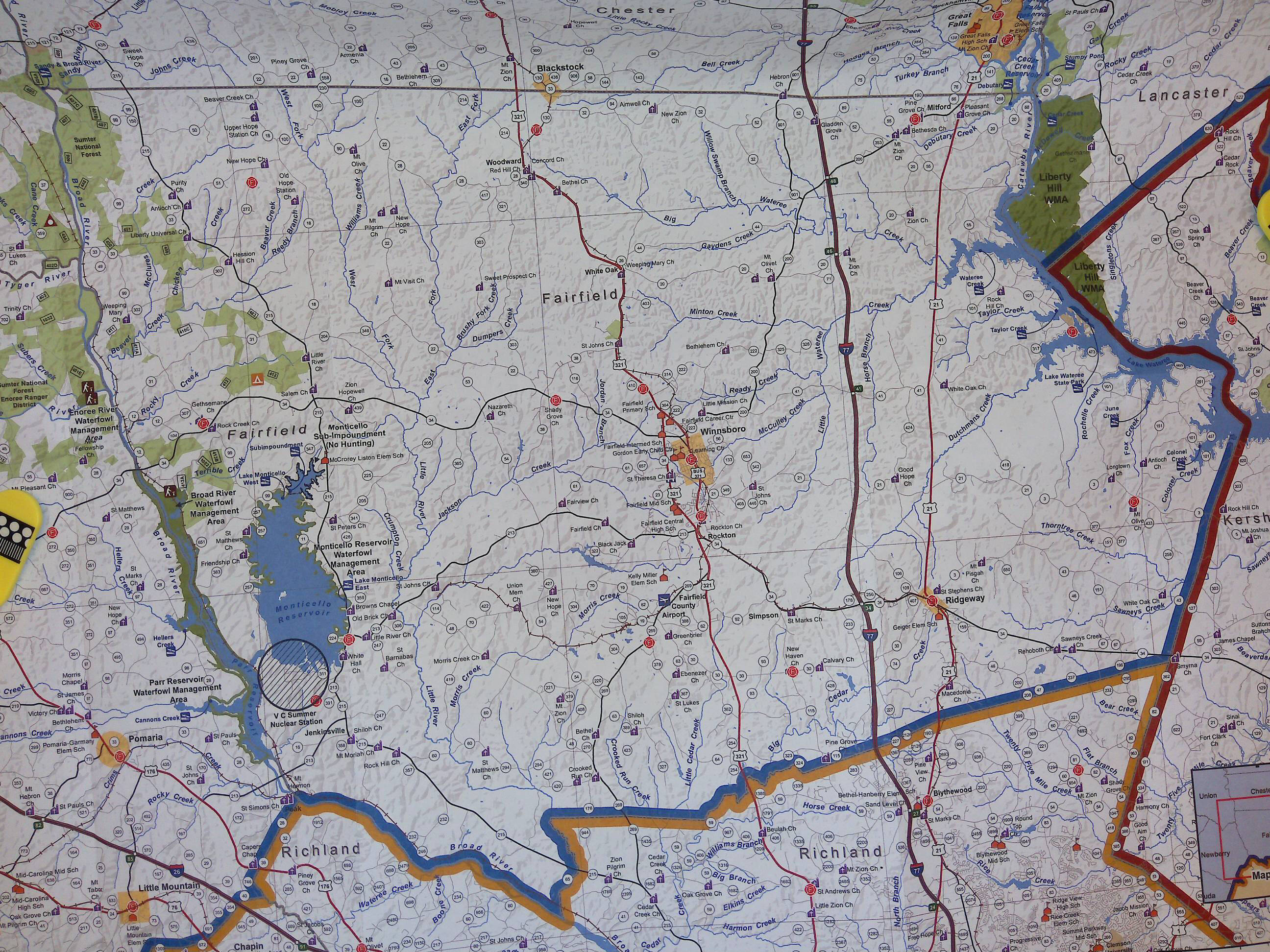 2014-2015 By SC Department of Natural Resources |
||||
Fairfield County .tif Maps For Overlay Project
(Intended For Research Purposes Only!)


Fairfield County Post Offices 1785 to 1970
by J. D. Lewis
(Intended For Research Purposes Only!)
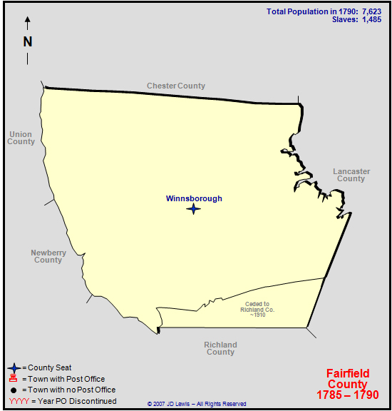 1785 to 1790 |
 1791 to 1800 |
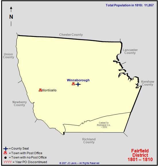 1801 to 1810 |
 1811 to 1820 |
 1821 to 1830 |
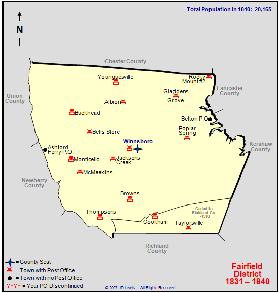 1831 to 1840 |
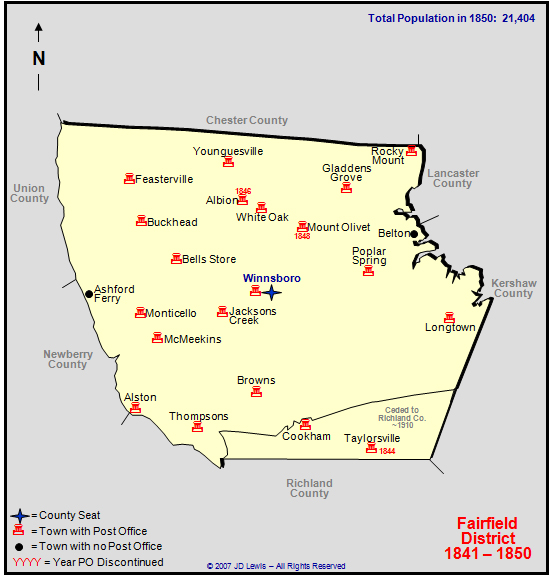 1841 to 1850 |
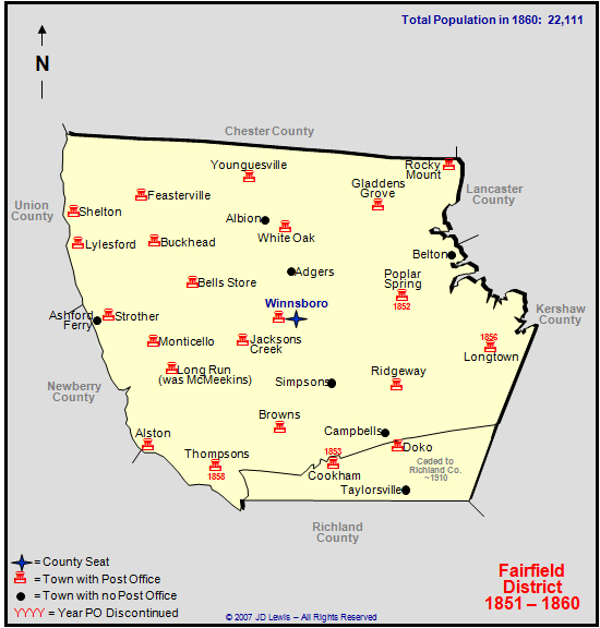 1851 to 1860 |
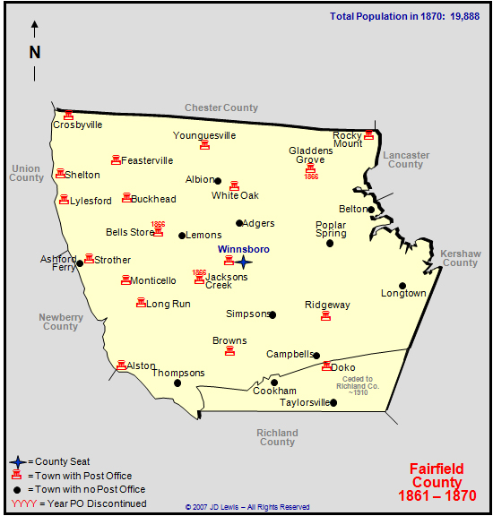 1861 to 1870 |
 1871 to 1880 |
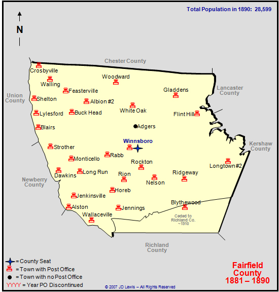 1881 to 1890 |
 1891 to 1900 |
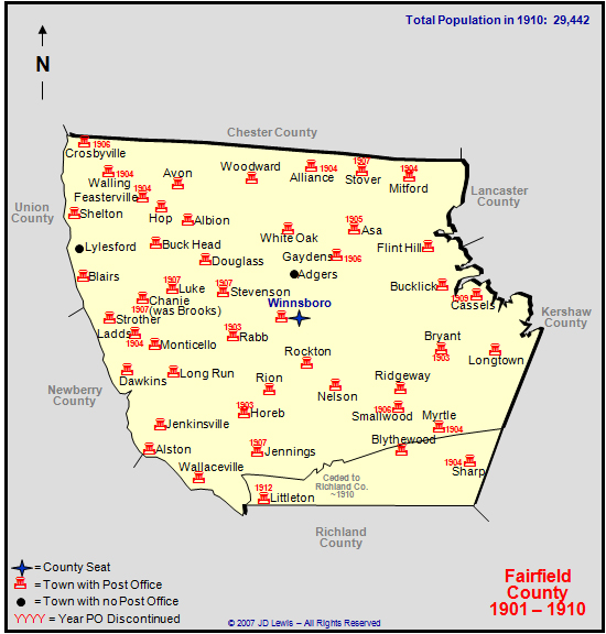 1901 to 1910 |
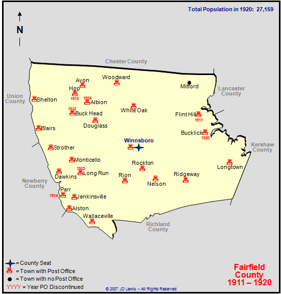 1911 to 1920 |
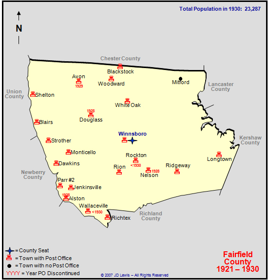 1921 to 1930 |
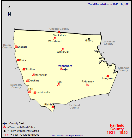 1931 to 1940 |
 1941 to 1950 |
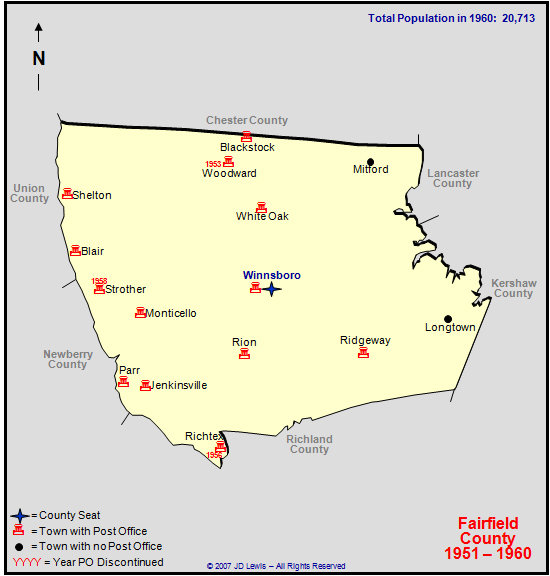 1951 to 1960 |
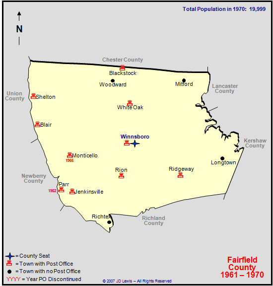 1961 to 1970 |
|
Winnsboro
(Intended For Research Purposes Only!)
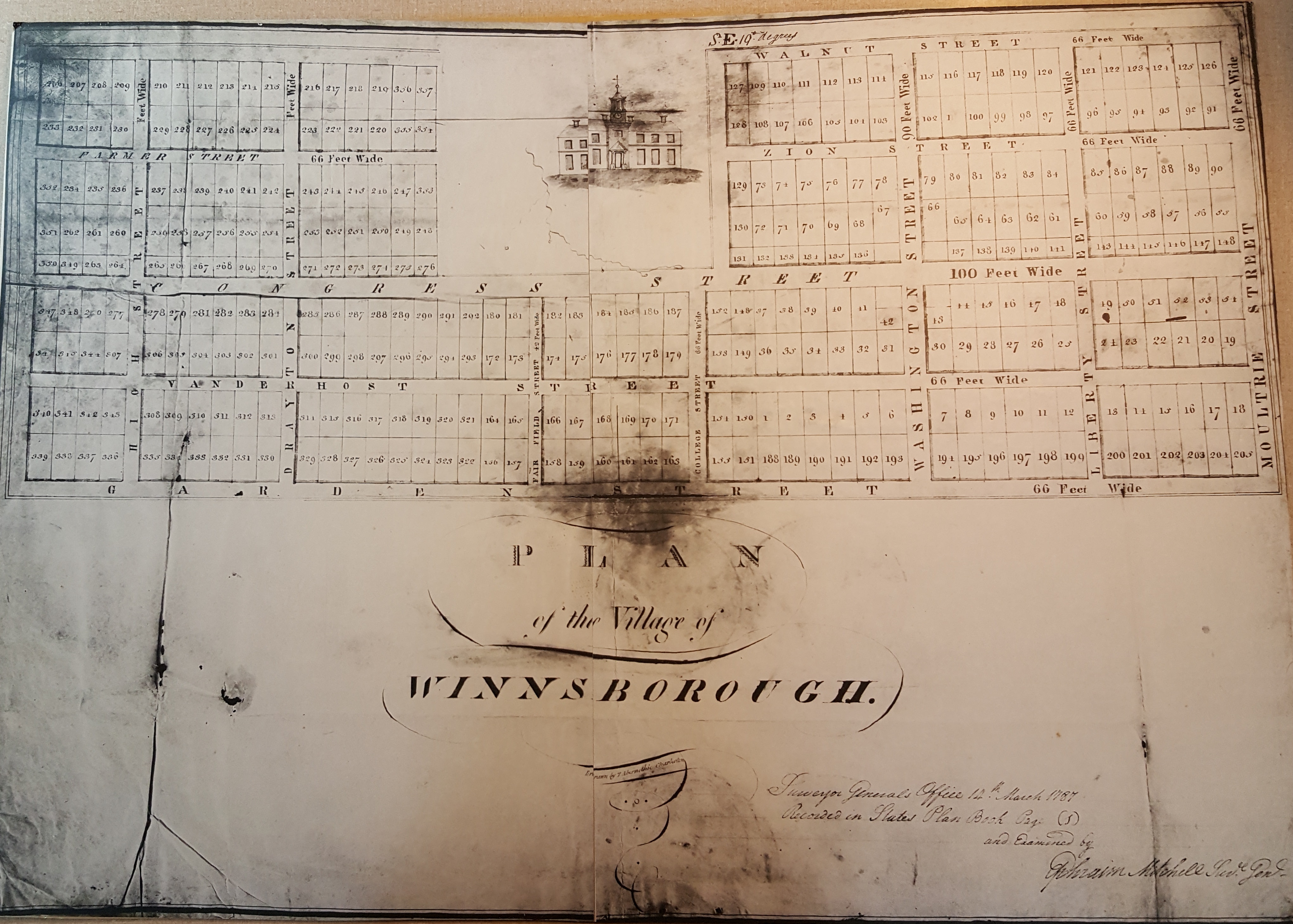
Plan of the Village of Winnsborough - 14th March 1787
1925 Winnsboro Maps (Map 1 Contains Index)
by Sanborn Map Company
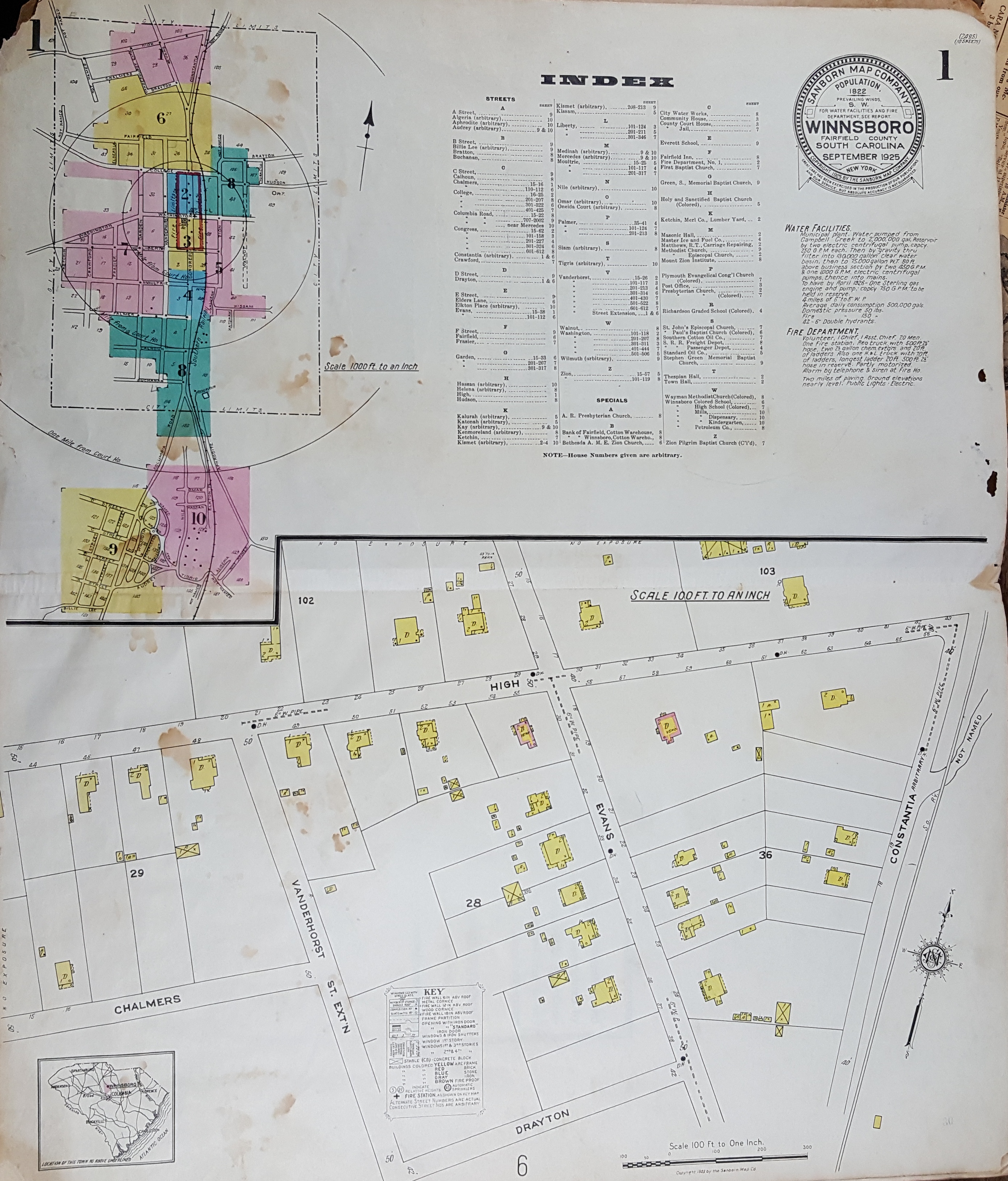 1 |
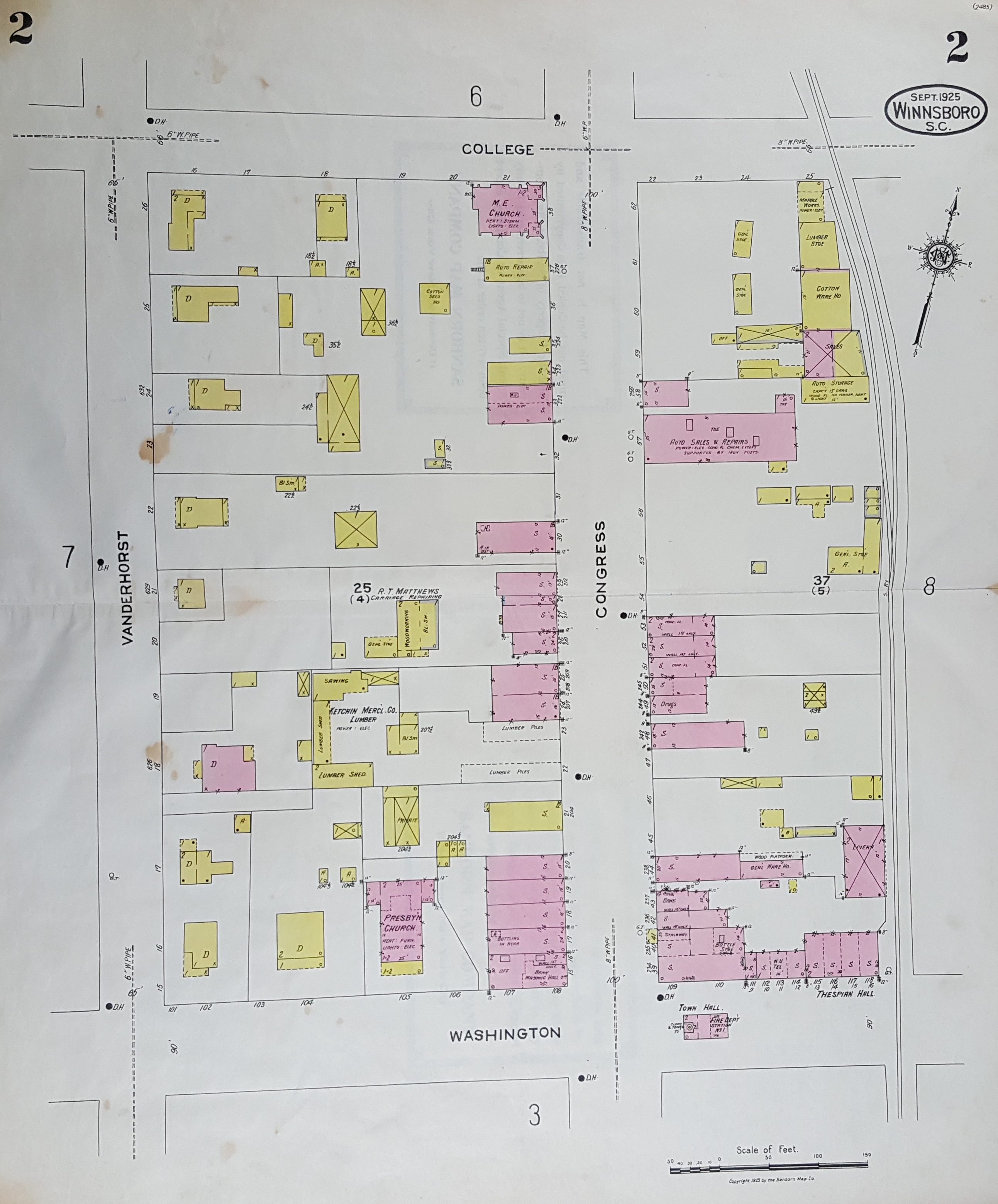 2 |
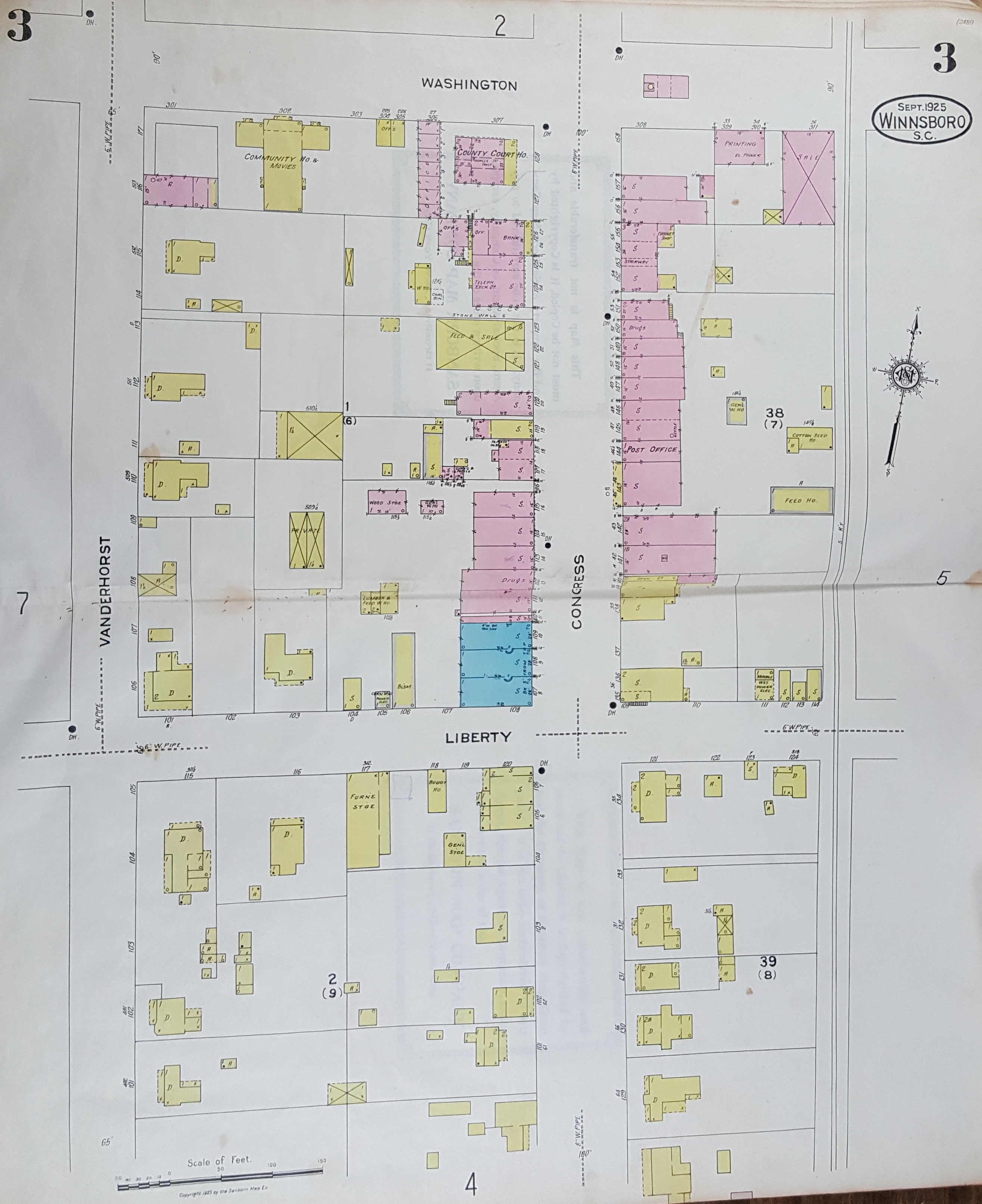 3 |
 4 |
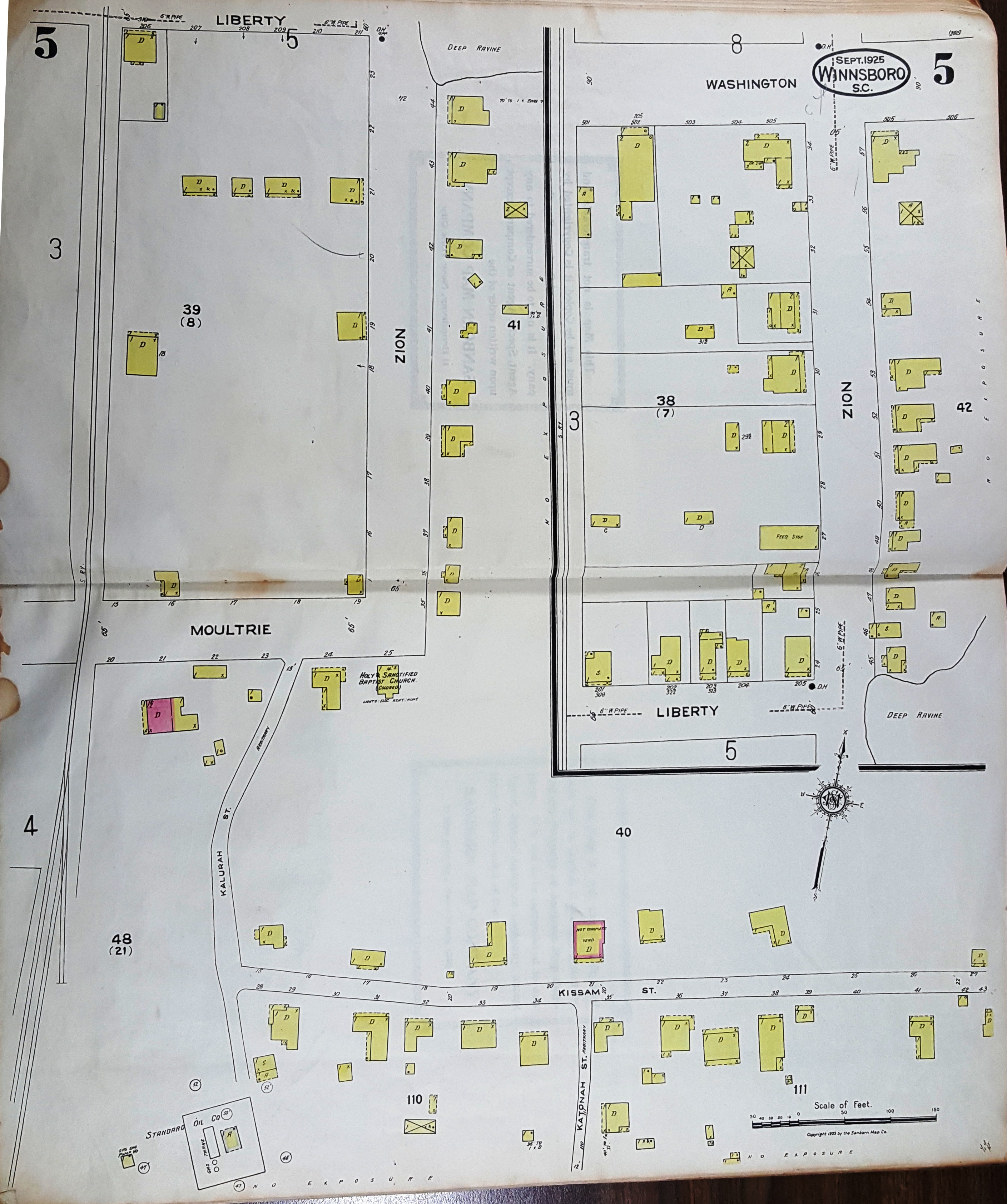 5 |
 6 |
 7 |
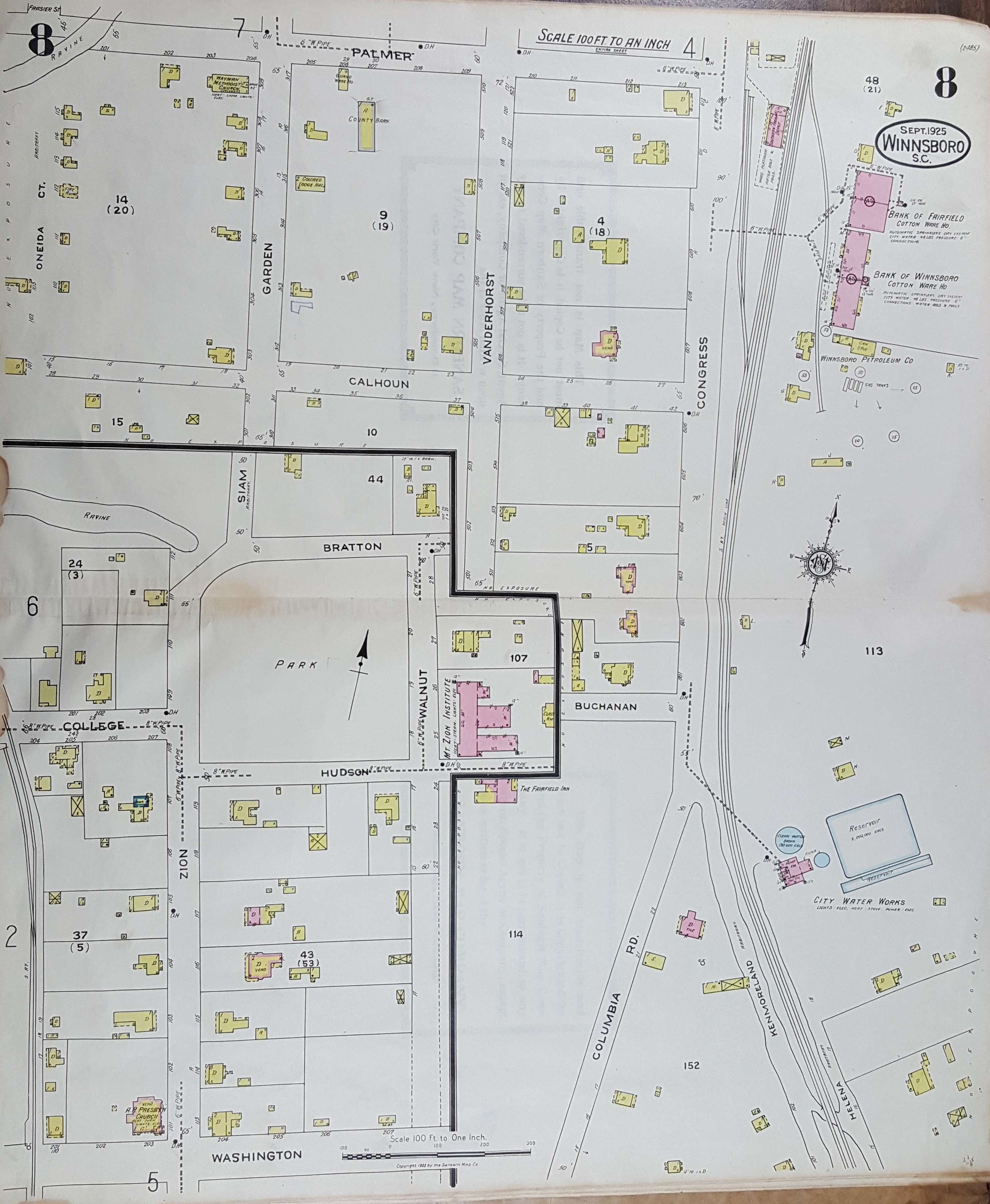 8 |
 9 |
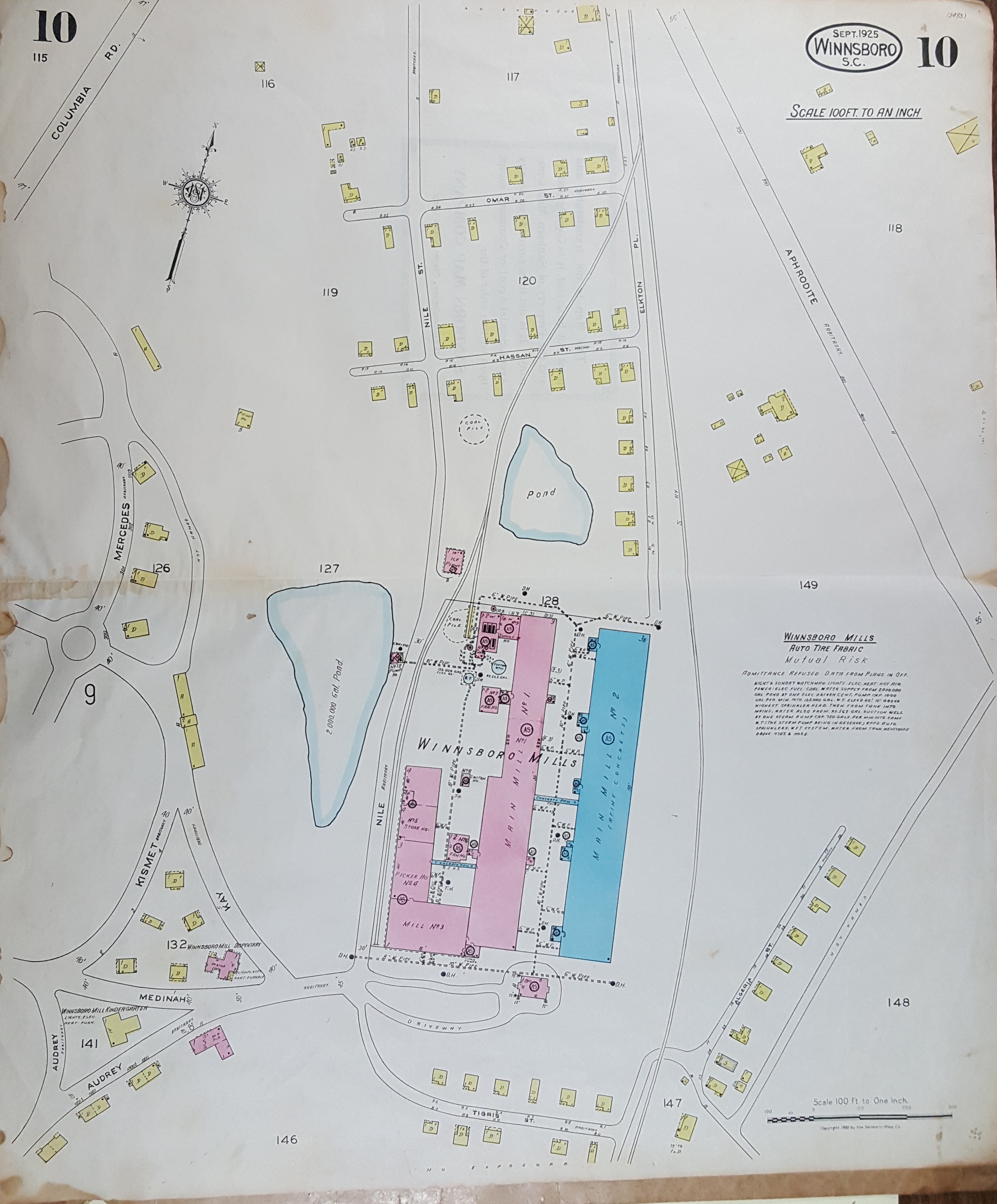 10 |
Excellent Map Reference Sites
Current GIS Map by Fairfield County Board of AssessorsACME Mapper by Google Maps